Current Conditions on Highway 88
Current Conditions in Kirkwood
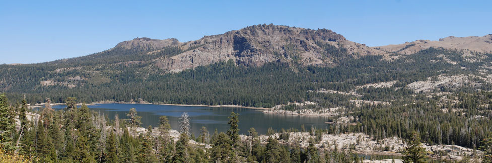
Kirkwood Mountain has a base elevation of 7,800 feet and is centrally located on Carson Pass, making it a good measure of weather conditions from Silver Lake to the summit of Carson Pass. Carson Pass itself is 8,600 feet, only 800 feet higher than Kirkwood.
The eastern side of the Sierra can often have quite different weather than the western slope. It is not unusual for Hope Valley to catch a summer thunderstorm while Silver Lake basks in sunshine. In general the snowfall is less on the eastern side of the pass. Kirkwood, however, is known for record winter snow.
Kirkwood Weather and Snow Conditions
Is Carson Pass Open?
Cal-Trans tries to keep Carson Pass open year-round. When the road does close temporarily, it is usually because of avalanche danger on the Carson Spur (between Silver Lake and Kirkwood).
The best source for up-to-date information on Carson Pass (Highway 88) is
Caltrans - Road Information.
Also see Caltrans Chain Controls and Chain Installations
Mormon Emigrant Trail Road
A portion of the Mormon Emigrant Trail Road, which connects Highway 88 at Iron Mountain Sno-Park with Highway 50 near Pollock Pines, is closed seasonally by snow. The Highway 88 closure is at the Sno-Park. Five miles down the road is the other closure at Silver Fork junction. Since it is not a state highway, it is not found on the DOT website shown above.
For information of the Mormon Emigrant Trail Road, see
El Dorado National Forest Road Information.
Blue Lakes Road
Blue Lakes Road is maintained by Alpine County. Check Alpine County Current Road Conditions for information or call 530-694-2140 and press option 2.
National Forest Campgrounds - Open or Closed?
For the status of campgrounds on Carson Pass check the websites for the Forest Service, El Dorado Irrigation District, PG&E, and California State Parks websites.
National Forest Campgrounds
West side of Carson Pass: Eldorado National Forest Campgrounds
East side of Carson Pass: Humboldt-Toiyabe National Forest Campgrounds
El Dorado Irrigation District Campgrounds
Sly Park Campground and Silver Lake West Campground: El Dorado Irrigation District Campgrounds
PG&E Campgrounds
Blue Lakes Campgrounds: PG&E Campgrounds
California State Parks
Indian Grinding Rock State Park
Grover Hot Springs State Park
Snow Report Websites and Webcams
Snow Reports and Road Conditions
Kirkwood Snow Report and Road Conditions
For road conditions check Caltrans QuickMap
Webcams
Keeping Carson Pass Open in the Winter
Carson Pass has two areas that are particularly vulnerable to avalanches - the Carson Spur area between Silver Lake and Kirkwood and the eastern side of Carson Pass. Between the two, there are 22 different avalanche chutes that could send snow tumbling onto the roadway.
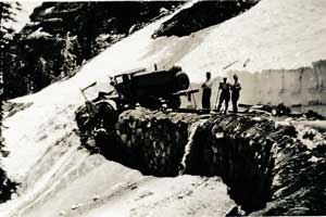
Clearing snow from the Carson Spur, 1935
Ever vigilant, Cal-Trans uses a variety of methods to prevent major avalanches. Lo-CAT artillery, hand charges, and other explosive devices are used to set off small slides before significant snow has time to accumulate above the roads. Often these measures require temporary closures of the road.
A more recent improvement over explosives has been the installation of the French GAZ-EX systems which uses propane and oxygen to set off blasts into the snow. Cal-Trans has also have constructed jet roofs on the hillside above Carson Spur. Jet roofs divert the flow of air and prevent the build-up of dangerous cornices.